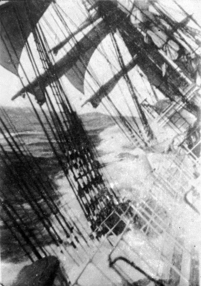
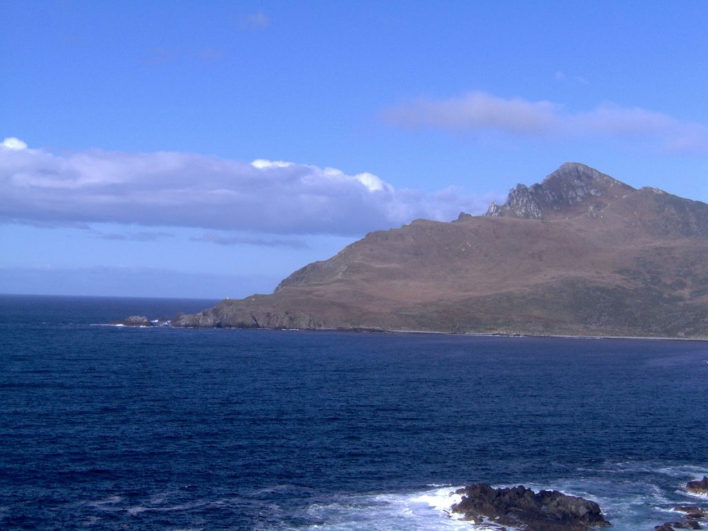
Before the completion of the U.S. transcontinental railroad (1869) and Panama Canal (1914) a major impediment to Euro-American exploration and colonization of Pacific lands was sailing around Cape Horn – the furthest-most point on the South American continent. The Spanish were the first to explore the region in 1526. In the late eighteenth century British and New England whalers began documenting extreme conditions while navigating the Drake Passage – the strait separating Antarctica from South America. Conditions included strong currents, fierce winds, and massive 40-foot (12m) “rogue” waves.
In 1813 the future first admiral of the U.S. Navy David Farragut experienced “dreadful weather” while waiting three weeks to “round the Horn…” Like many others, Farragut described a scene that tested the hardest and most experienced sailors:
Large quantities of water rushed down the hatchways, leading those below to imagine that the ship was sinking. This was the only instance in which I ever saw a regular good seaman paralyzed by fear at the dangers of the sea. Many of the marines and several of the sailors were seen on their knees at prayer…[1]
In an 1831 article, one sailor claiming to have “twice doubled” Cape Horn wrote that in the winter the “celebrated land of storms, whose very name strikes the ear of a seaman with dread… is almost one continued storm of wind, hail, snow, and ice.” He noted it could take a month for a ship to make headway against westerly winds that “blow with a violence that threatens instant destruction to a ship.”[2] One North Carolinian newspaper printed an officer’s account of rounding the cape in early 1840 aboard the USS Constitution (1797) – a three-masted heavy frigate that served as the flagship for the U.S. Navy’s Mediterranean and African squadrons. In 1840, the Constitution had embarked on an around-the-world trip that could have ended in disaster:
For twenty-two days it blew with awful violence, and snowed, and rained and hailed almost incessantly. …One can hardly form an idea of the power and sublimity of a storm at sea, who has not experienced one. You must hear the howling of the wind – the incessant roar of the ocean, and behold the mountain waves, appearing as if they would swallow the ship – at one moment lifted up on the monstrous waves, and then pitched headlong into the trough of the ocean – the waves breaking over the decks, the masts creaking, the vessel groaning. […] The most wearying thing during the storm, is the pitching and rolling of the ship, which you must be constantly guarded against, or you may be killed at any moment.[3]
When the California Gold Rush began in 1849 scores of pioneers known as “Forty-niners” endured the 15,000-plus mile (24,000km) ocean journey from the east to west coast. The journey often took more than eight months. More circumspect travelers opted for the one-month trip via Panama that required traversing the mountainous jungles separating the Atlantic and Pacific. Rather than take their chances with rounding the Horn, many mariners preferred to enter the Pacific Ocean via Africa and the Cape of Good Hope even though that route was considerably longer. In Herman Melville’s 1851 novel Moby Dick, the New England whaling ship Pequod used that route. In 1853, Commodore Matthew Perry’s Expedition to Japan also transited the Indian Ocean to avoid Cape Horn’s treacherous waters.
One hundred years after Admiral Farragut’s daunting voyage, the Gamboa Dike separating the Atlantic and Pacific was destroyed in a planned explosion that flooded the Culebra Cut creating the Panama Canal. U.S. Secretary of the Navy Josephus Daniels heralded it as “a mammoth carving knife that cuts and slashes distances in a record-breaking” speed. “Without the canal it would require four months for an Atlantic fleet to round Cape Horn… with the canal it will require less than four weeks.”[4] A mari usque ad mare.
[1] Loyall Farragut, ed. The Life of David Glasgow Farragut, First Admiral of the United States Navy (New York: D. Appleton and Company, 1879), 20.
[2] Vermont Gazette, July 5, 1831.
[3] The Raleigh Register, June 30, 1840.
[4] The Boston Globe, October 28, 1913. “Canal Means no Invasion”
About the author
Benjamin J. Swenson has been living and working in Korea since 2008. His doctoral dissertation at Pompeu Fabra University (UPF) in Barcelona, Spain, covered Euro-American military and legal history, and the advent of guerrilla warfare and counterinsurgency doctrine in the nineteenth century. He is currently an Assistant Professor in the Department for Human Creativity at Hoseo University in Asan – where he lives with his wife and son. His hobbies include chess, painting, hiking, and bonsai.

My ancestor Captain Kendrick was on of the first Americans to round Cape Horn to trade with the indigenous people of the Northwest and to seek the Northwest Passage. This happened just after the Revolutionary War.